You love independence.
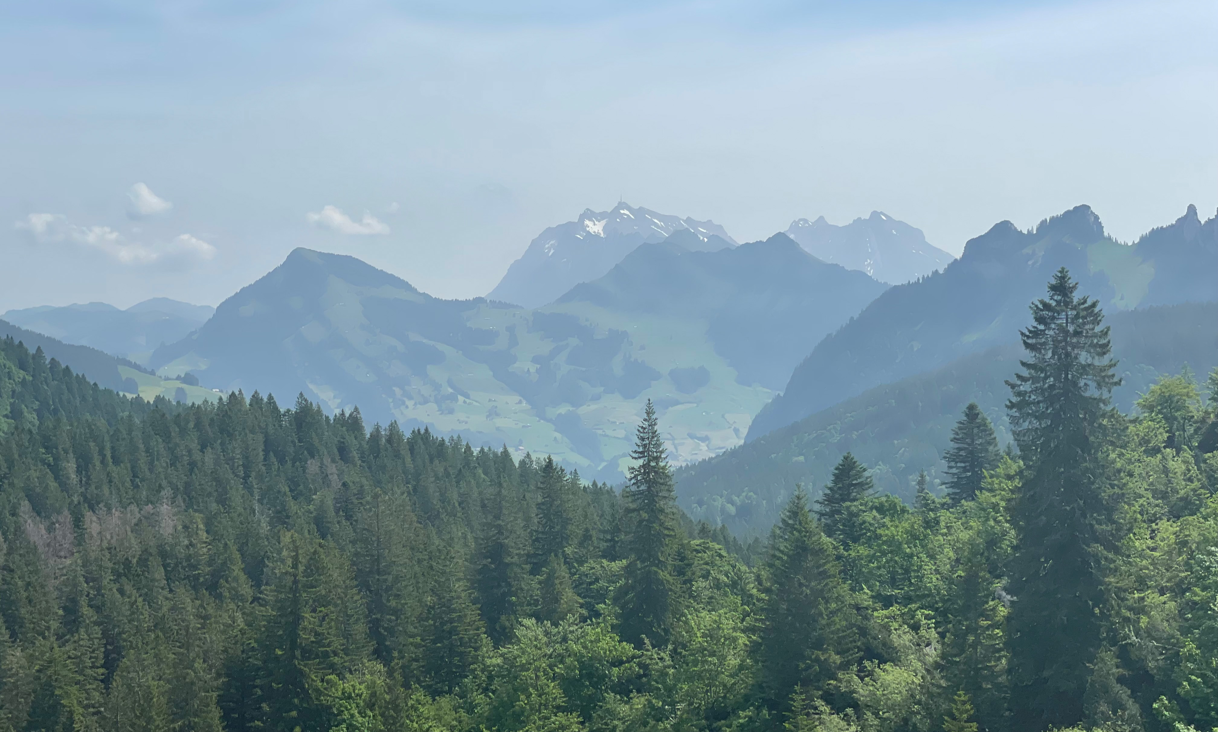
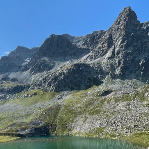
You are interested in more than just the beaten track. You plan your own hikes and explore new paths.You are unique.
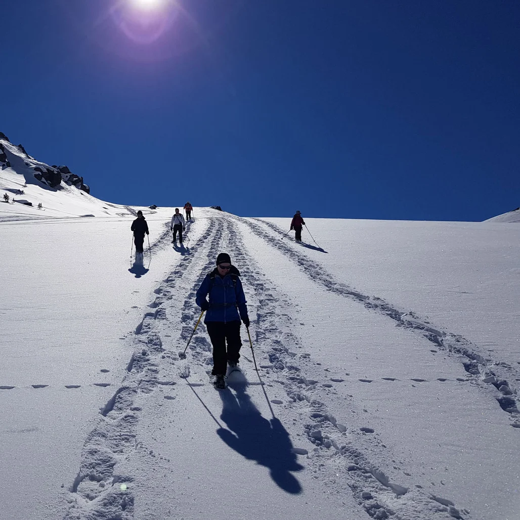
One time you want to explore a challenging route and another time you want to discover a picturesque walk. With snowshoes in winter and preferably in the shade in summer.You take responsibility and value safety.
Anyone who wants to discover and explore, who plans and carries out a mountain hike, is dependent on precise information and tools.Independent
Swiss Pro Map provides maps and data from various sources. These, along with all tools — except for weather data — are also available offline. Your location, tracks, and routes always remain private and stored locally on your device unless you deliberately share them with someone.
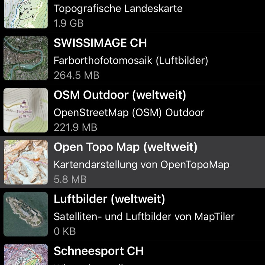
You decide which map material you want to use.
Maps and aerial images from swisstopo, OpenStreetMap, OpenTopoMap and MapTiler.
For Swiss Pro Map, we have optimized maps from OpenStreetMap especially for hiking and outdoor activities.
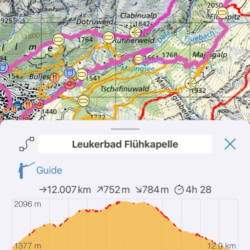
You plan your own routes.
Swiss Pro Map automatically finds routes along hiking trails, paths and roads. SwitzerlandMobility routes are also available.
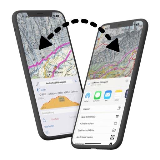
Routes can also be entered manually or recorded as a track. Routes are displayed with an altitude profile, distances and your current position in the altitude profile. They can be edited and shared.
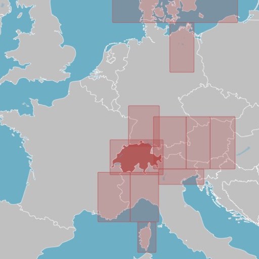
You don't limit your excursions to Switzerland.
Elevation models for Western and Central Europe. POIs and roads for the entire Alpine region, as well as Corsica, Scandinavia, Northern Germany, the Canary Islands, Morocco, Nepal and others.Non limitano le loro escursioni alla Svizzera.
You do not need an Internet connection when you are on the move.
As soon as the data has been downloaded, not only the maps but also all functions such as search and route planning are available offline.
Everything you see in Swiss Pro Map has already been downloaded and remains on the device until you delete it.
Your data belongs to you.
Your location and routes remain private on your device - we have no access to them.
No registration is necessary for Swiss Pro Map. We never ask for personal data and do not send advertising emails or newsletters.

Share routes and location data.
Swiss Pro Map not only supports GPX, KML and KMZ files, but also coordinates in the formats Google Plus Code, Apple, Waze and Google Maps URLs, OSM short links and many more.
Swiss Pro Map not only runs on Android and iOS, but also on all Macs with an M1 processor or higher: you can plan your trips on a large screen.
Versatile
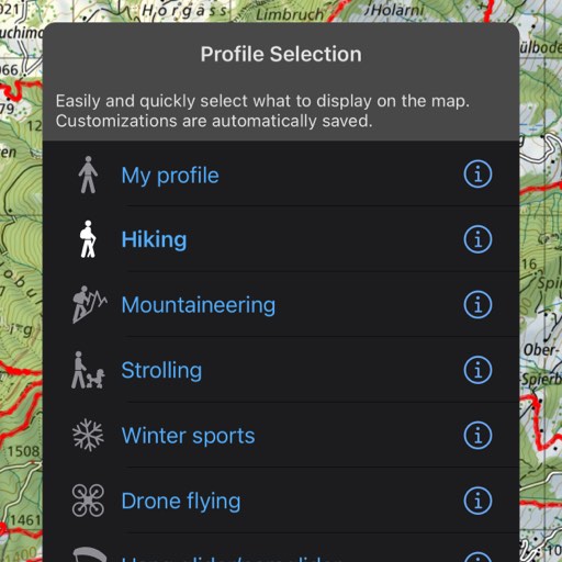
Swiss Pro Map adapts to your needs.
Whether hiking, mountaineering, flying, skiing or cycling - the profiles provide presets for your outdoor activity.
You can switch effortlessly between different areas of application. We have prepared nine profiles. These profiles can be customized. As soon as a profile is active, your changes are automatically saved in the corresponding profil
You have everything at hand for your journey.
The public transport stops and the current SBB timetable are also available offline.
Parking spaces, signposts, benches, tourist attractions, viewpoints and much more can be displayed as required.
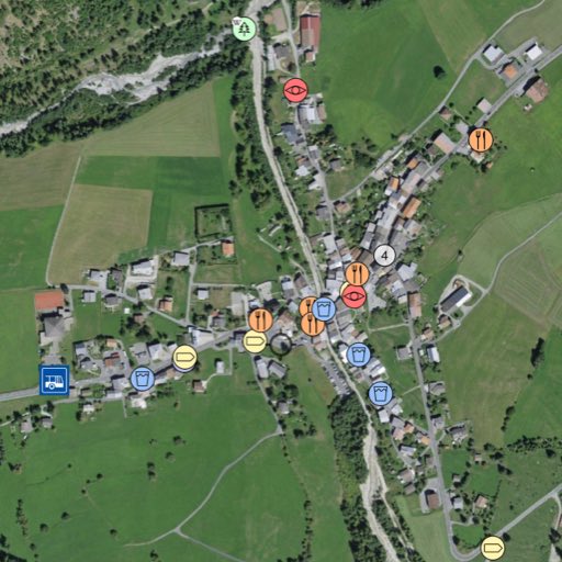
You will find what you need for your excursion.
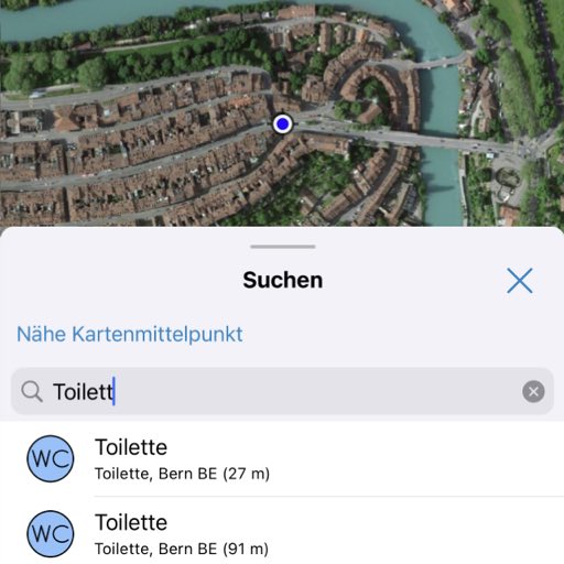
You can search specifically for objects in the vicinity of the center of the map. For example, you can search for drinking water or toilets while on the move
Search for place and field names, municipalities, POIs, coordinates, addresses and SwissMobility routes. Of course, all this is also available offline, except when searching worldwide.
Want to know how far it is to the ice cream?
Our guide collects information that matches a route. It not only displays ascents and descents, kilometer markers or the highest point, but also fountains, fireplaces, restaurants, fireplaces, places of interest, etc.
The guide calculates the walking time until such a location is reached. You decide what is displayed.
Reliable
The app emphasizes precision. Exact information is essential, especially for navigation and rescue.
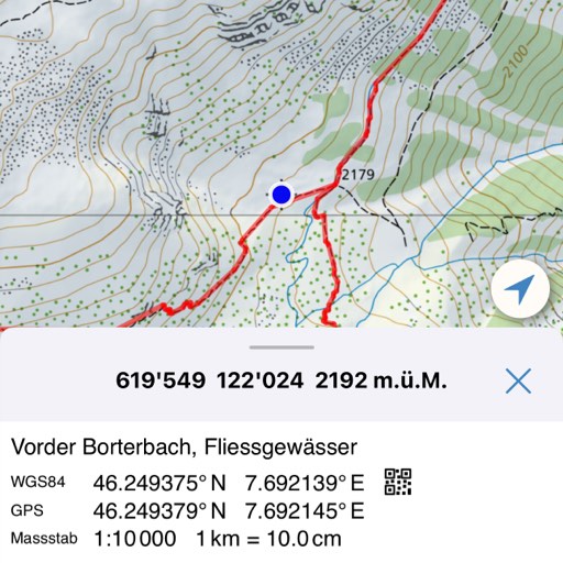
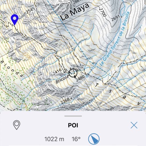
Coordinates, altitude and position.
The current position on the map is available at all times, even offline, with the coordinates and altitude.
The search function can be used to find coordinates in various formats and display them on the map.
Latest data.
We make sure that you can always download the latest map material to your smartphone.
Closed trails and restricted military shooting areas in Switzerland are updated daily.
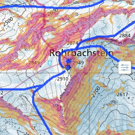
Navigation and orientation.
Zoom without moving the position on the map.
Optional alignment of the map with a compass..
A pointer indicates the direction and distance to a marked location.
Navigation along a route with display of the next route point.
Use in difficult conditions.
A reduced operating mode makes it easier to use the app in the field.
All maps can be displayed in double size and optionally with increased contrast.
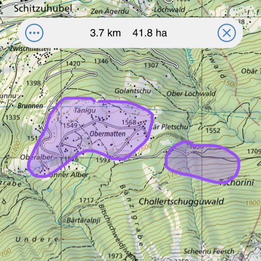
Measure and draw.
Measure distances and areas - precisely or, if you need to do it quickly, simply draw on the map with your finger.
Draw and label areas. The drawn areas can be shared with others.
Additional important information.
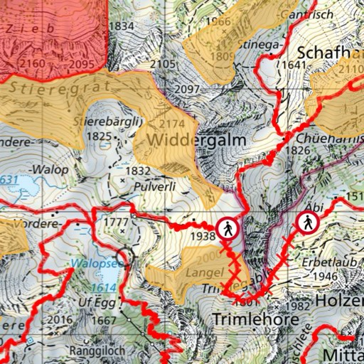
Herd protection dogs, wildlife rest zones, wildlife protection areas, hazard zones, swisstopo map sheets, SAC huts, shelters, and much more.
For winter sports enthusiasts, the snow sports map includes information on slope inclination in addition to snowshoe and ski routes.
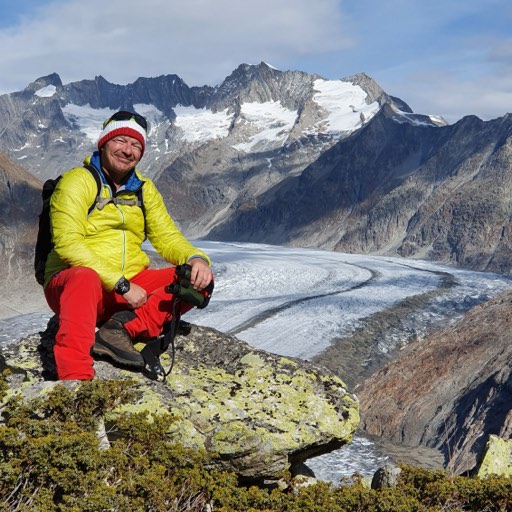
Experts rely on Swiss Pro Map.
«There are many map apps, but none as versatile as Swiss Pro Map.»
«As a hiking guide, I travel throughout the Alpine region, Corsica, Cappadocia and even the Himalayas all year round. For this, I need reliable maps for planning, precise navigation on site and, if necessary, a quick adjustment of the route. An app from professionals for professionals.»
Reini Meichtry, hiking guide simply.hiking
«I like Swiss Pro Map because of its versatility.»
«The app gives me the security that is important for my work: you can adjust the walking speed for time management. The information about public transport stops and closed routes is well displayed and linked.»
Chantal Lörtscher, J&S/SBV, hiking and snowshoe trecking guide Erlebnis Wandern
An Overview
See this video on YouTube
Try out the app before you decide.
Use the app for 14 days free of charge and to its full extent - without taking out a subscription.